Nearest town: Blandford Forum
Site type: field
Access: Private
Church name: No Data
Diocese: No Data
County: Dorset
Country: England
Grid ref: SU03851000
Lost yew site: No
Date visited: 25-Jun-03
Recorded by: Tim Hills
Protection & responsibility: Landowner
Yews recorded at this site: Ancient 5m-7m
Notes: In a field with no public access. Rye Hill was the centre of a large deer park in the 13th century, a time when deer parks were usually rough grassland with scattered tree cover. The yew appears on a map published around 1900. The archaeologist Heywood Sumner measured it about 100 years ago, and its girth has only increased by a few inches since that time.

| Tree ID | Location | Photo | Yews recorded | Girth |
|---|---|---|---|---|
| 1689 | Rye Hill | 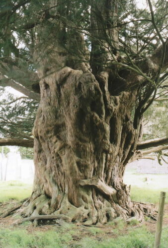 |
Ancient 5m-7m | 673cm at 75cm - view more info |
