Nearest town: Cleobury Mortimer
Site type: hedge
Access: Public
Church name: No Data
Diocese: No Data
County: Shropshire
Country: England
Grid ref: SO67388307
Lost yew site: No
Date visited: 15-Sep-17
Recorded by: Paul Wood
Protection & responsibility: No data
Yews recorded at this site: Notable
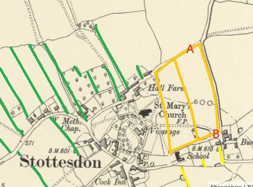
Notes: The Village of Stottesdon in Shropshire has much recent development and infill within the village. The 1st edition OS map shows that the village had a medieval planned form, a stereotypical layout for many villages through out the UK. Though parts of the church are thought to be very early Dark Age at about 450CE, most of the church, which is the oldest building in the village, is post Norman and the planned strip field (green on the map) and burgage plots (yellow on the map) are a system well established by the 13th century in Britain. I cannot find Stottesdon as a named Domesday Book settlement but it does not mean there was not one in place. Current evidence from the map suggests 12th/13 th century and this is important because of the two sites indicated on the map as A and B. These are on the bank of the burgage boundaries and important because here are large yews that could be contemporary with the laying out of the settlement.
| Tree ID | Location | Photo | Yews recorded | Girth |
|---|---|---|---|---|
| 5222 | Stottesdon | 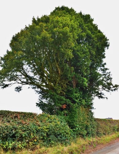 |
Notable | No data available - view more info |
| 1547 | Stottesdon | 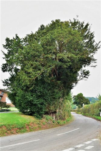 |
Notable | No data available - view more info |
| 1546 | Stottesdon |  |
Notable | No data available - view more info |
