Nearest town: Abergavenny
Site type: boundary
Access: Public
Church name:
Diocese:
County: Herefordshire
Country: England
Grid ref: SO30233144
Lost yew site: No
Date visited: 4/10/2016
Recorded by: Paul Wood
Protection & responsibility: landowner
Yews recorded at this site: Ancient 4m-5m, Notable
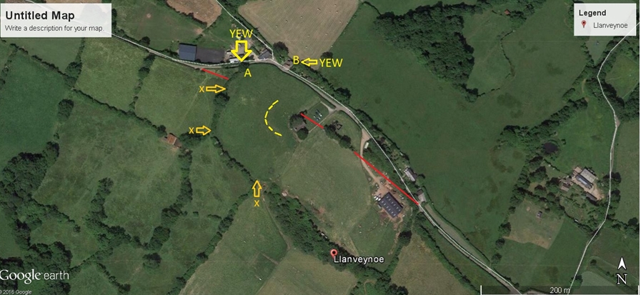
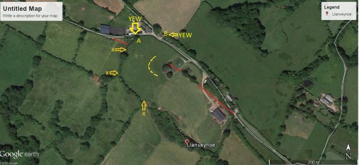
Notes: A remote location beneath the Black Mountains. The curving ditch is shown on the map as a broken yellow line. The current hedge boundary with the two yews in has been marked X. It reflects the curving ditch in the field nearer the church. Also note that the red line probably marks a boundary or road that has been truncated by the church and its present setting. The 1st edition ordnance survey map shows a network of roads leading seemingly to nowhere. This site is puzzling and asks the question whether this was once a major church or monastic site in the so called Dark Ages.
| Tree ID | Location | Photo | Yews recorded | Girth |
|---|---|---|---|---|
| 4995 | Llanveynoe - Olchon Valley | 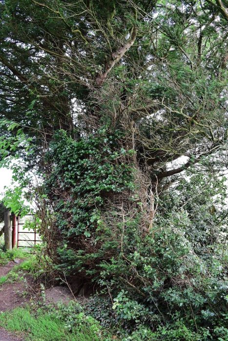 |
Ancient 4m-5m | No data available - view more info |
| 6594 | Llanveynoe - Olchon Valley | 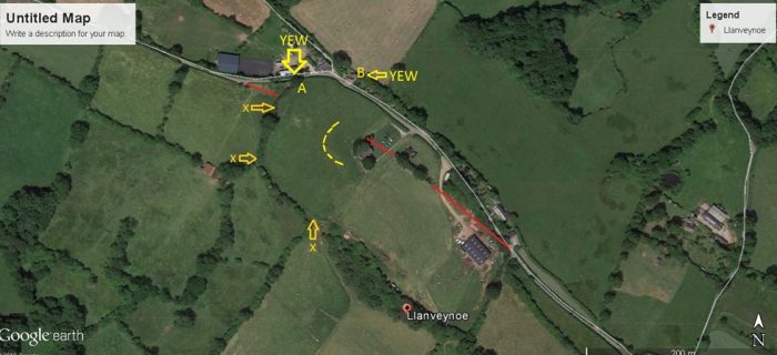 |
Notable | No data available - view more info |